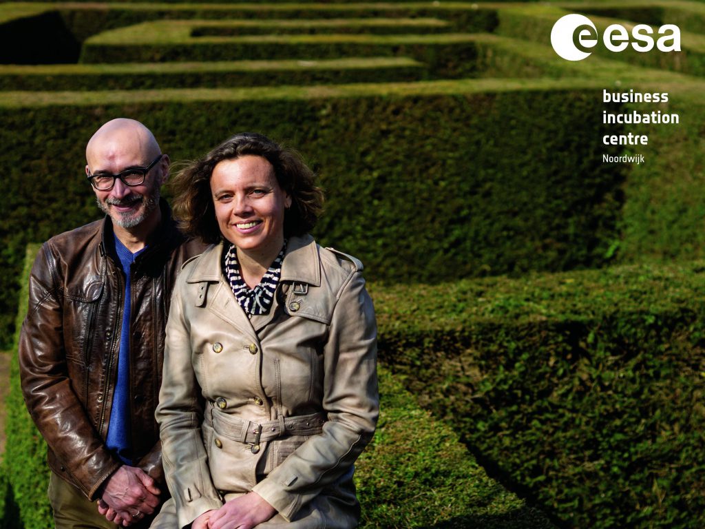
In infrastructure, certain things like measuring surface deformation are done in a conventional way. Instead of focusing on measuring what’s wrong, Survey Intelligence – graduate of the ESA BIC Noordwijk programme – is able to tell what’s about to go wrong. How do you address a sector where your solution requires this shift in thinking? We talked to co-founders Reda Meftahi and Maud van Ees about their journey as a space related business in an infrastructural world.
What makes your business so unique?
Maud: We combine the quantitative aspect of in situ measurements, done by land surveyors, with the qualitative aspect of satellite data.
What makes it unique, is that we made our analysis with satellite data 100 percent comparable to in situ instruments. What we’ve seen, competitors are only up to 50 percent accuracy.
So why not only measure it with in situ instruments then?
Maud: We let both datasets work together so we can calibrate the satellite data. Usually, customers think we want to get rid of the in situ measurements, but that’s not the case. You shouldn’t, but you should combine the best of both worlds. We combine satellite data with sensors. This way you can see the whole picture, and more!
Reda: Satellite data is qualitative data, it’s an approximation. For being a true displacement, you need the quantitative data from ground sensors to measure precisely. It’s expensive though to use a lot of ground sensors, so it’s economically interesting to track a large area with satellites. Moreover, sensors are often placed randomly and using our knowledge acquired with satellite data helps optimise their positioning. So if both worlds work together, you have high quality measurements on a large scale.

Can you describe how you shaped Survey Intelligence during the ESA BIC programme?
Reda: We started with analysing the limitations of the current ground motion maps based on satellite data. There is a problem with the resolution of data and with accuracy of measurements. The technology used is around for at least 2 decades and is rather outdated. The maps only focus on vertical movement and deformation which has already taken place. It doesn’t allow for any predictions. So we listed the things we thought should be optimised, and started from there.
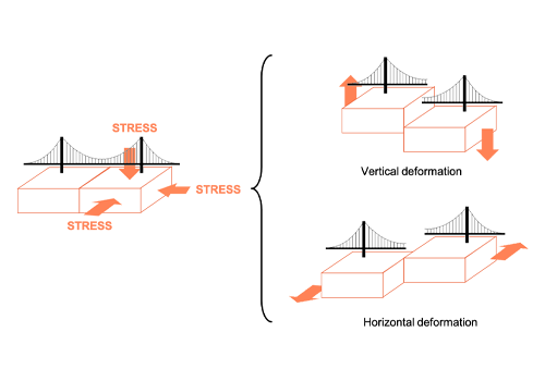
We quickly discovered that ground movement was underestimated. Ground motion not only happens vertically, but also horizontally and the combination of the two in a three dimensional space. Geologically, it makes sense to not just focus on infrastructure (e.g. roads, bridges, houses), but also on their surrounding environment and the impact that the surface has on the object. Resistance to ground movement generates stress on objects, and stress evolves into damage. This is why we focus on detecting stress before damage occurs.
A construction doesn’t break overnight. It breaks because it accumulates stress for a couple of years. We can see the growth of stress and where it is applied and where it will create a defect. We are basically making the relation between object and environment visible. That’s what we’ve been working on the last few years.

What are the main challenges the infrastructure industry is facing now?
Maud: It’s climate change. When talking about climate change, everyone is talking about heat or flooding. But nobody thinks about subsidence immediately. Because it doesn’t happen overnight, it’s hard to grasp and to visualise . But due to climate change, ground deformation (e.g. landslides and sinkholes) increases significantly and becomes more and more unpredictable leading to dramatic results.
Also, human impact on ground motion is more important than you think. Think of the impact of underground storage of energy, or the production of geothermal energy on its surrounding environment. Think of growing populations that need housing to be built, with more roads and train tracks, all impacting the ground beneath them. On top of that the lifecycle of the existing civil infrastructure, mainly built in the 1960’s, is coming to an end and will need extra attention for maintenance and replacement. So that’s something to think about as well.
Reda: Designs in construction right now are based on a more stable climate. The climate is changing fast and that should be incorporated in the design of new infrastructure. Also, ground motion increases the costs of maintenance and inspections. New technologies can help the industry to optimise their limited resources. So it’s our challenge to make stakeholders aware of the problems they are about to face and how to address them.
Can you tell us about the projects you were involved in?
Maud: We did projects with Rijkswaterstaat (the Dutch Department of Waterways and Public Works) and VolkerWessels, one of the biggest construction companies in the Netherlands. We are currently working on a project for the German railway, and in France we are involved in a highway project.

Where will Survey Intelligence be in 5 years?
Maud: We want to be the leading provider of ground deformation analysis with the help of satellite data. We find the insurance market interesting, so our focus will not only be in civil engineering. Insurance companies could use our data for defining risks for house insurances. When we started in the ESA BIC programme, we thought of the energy market first but they were not into satellite data (yet). So that’s when we moved to civil engineering. Within 5 years we should’ve entered the insurance market for sure.
Do you have any advice for aspiring entrepreneurs working in or with the space industry?
Reda: The space industry is not a fast industry. Satellite data has immense possibilities, but if you want to start a business with the output, it’s going to take some more time than in other domains to get going. You need to be patient and prepared.
Also, it’s not that simple to explain the benefits of space data to other industries. You really need to make an effort in addressing your message. Don’t assume that people know what you are talking about; you have to make it crystal clear for them.
Maud: Focus on your core business and competences. Partner with other companies when you don’t have the knowledge in-house. At the start, we wanted to do everything ourselves – from data management to visualisation, hosting, etc. That just takes a lot of time. So don’t try to reinvent the wheel.


